Wetenschap
Wat we weten — en niet — over de gevolgen van klimaatverandering voor orkanen zoals Ian
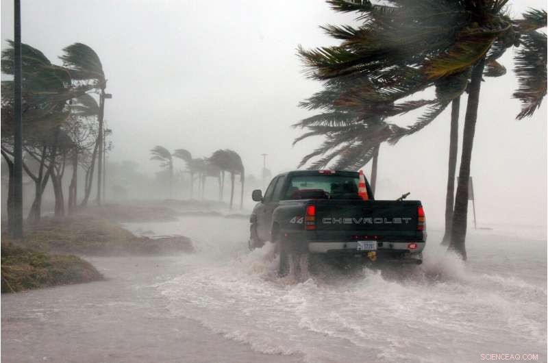
Krediet:Pixabay/CC0 publiek domein
Het is een vraag die volgt op elke natuurramp, vooral monsterorkanen zoals Ian:werd dit veroorzaakt door klimaatverandering?
Desgevraagd duwen wetenschappers zoals Kevin Reed zich meestal terug. De meeste onderzoekers zijn het erover eens dat het niet geldig is om naar een enkele storm te wijzen en te zeggen dat deze werd "veroorzaakt" door de opwarmende wereld. Te veel variabelen.
"Dat is een vraag die heel moeilijk te beantwoorden is. Er is geen 'hoe zou september 2022 eruit hebben gezien zonder klimaatverandering?' Dat hebben we niet", zegt Reed, universitair hoofddocent aan de school voor mariene en atmosferische wetenschappen aan de Stony Brook University.
Maar er is een groeiende consensus dat de zeespiegelstijging en hogere temperaturen in de afgelopen honderd jaar al een impact hebben gehad op stormen zoals Ian, die vorige week Florida overspoelden, en dit in de toekomst mogelijk zullen blijven doen. Op zijn minst betekent warmer weer hetere oceanen, die de orkaankracht voeden.
"We leven in een wereld die meer dan 1 graad warmer is (Celsius), het lijdt geen twijfel dat orkanen in een bepaald opzicht zijn veranderd als gevolg van klimaatverandering," zei hij.
Tom Knutson, een senior wetenschapper bij NOAA die klimaat en orkanen bestudeert, zei dat wetenschappers het meeste vertrouwen hebben in het opmerken van wat er is veranderd aan stormen in de moderne wereld. Maar minder over het kunnen koppelen van die veranderingen aan klimaatverandering. Voorspellen wat de toekomst zou kunnen brengen, is nog moeilijker.
Dat komt omdat orkanen en wereldwijde weerpatronen duivels ingewikkeld zijn. Sommige veranderingen in de atmosfeer en stormen kunnen bijvoorbeeld worden toegeschreven aan de hoge niveaus van fysieke luchtvervuiling, naast broeikasgassen, die in de atmosfeer worden uitgespuwd.
Storm-tracking-technologie is de afgelopen eeuwen ook enorm verbeterd. Wetenschappers zijn het erover eens dat we nu veel meer "rommelstormen" opvangen - kortstondige en zwakke cyclonen - dan ooit. Dat kan gegevens scheeftrekken, en daarom zijn de meeste wetenschappers voorzichtig bij het trekken van een directe lijn tussen een warmere aardbol en het aantal orkanen.
"Het is een vrij complex beeld en als toevoeging aan de complexiteit, leiden we veel van deze dingen af uit klimaatmodellen die zelf onzekerheid hebben", zei Knutson. "We moeten voorzichtig zijn."
Hier staat de wetenschap op verschillende fronten:
Hogere stormvloed waarschijnlijk
De zeespiegel in de buurt van Zuid-Florida is sinds 1950 al ongeveer twintig centimeter gestegen, volgens de gegevens van de NOAA. Dat betekent dat het water vanaf een hoger basisniveau begint, waardoor de orkaangolf een paar centimeter hoger kan reiken en meer grond kan bedekken.
Researchers expect sea level rise to accelerate as hotter temperatures cause polar ice sheets to melt faster. Over the next century, South Florida can expect to see more than three feet of sea level rise, according to estimates from the UN Intergovernmental Panel on Climate Change (IPCC). That will push storm surge higher when hurricanes roll through coastal communities.
One 2020 study modeled what 21 hurricanes that struck between 2000 and 2013 might look like under the climate conditions expected in 2100. The researchers estimated that, on average, floods would have been about 30% worse and covered about a quarter more land.
More extreme rainfall
One of the most straightforward connections between climate change and hurricanes is rain. Like anyone who's experienced humidity knows, warmer air holds more moisture.
For every 2 degrees Fahrenheit of warming, there is about 8% more water in the atmosphere, and the world has warmed at least 2 degrees Fahrenheit since pre-industrial times.
So perhaps it's no surprise that one study of the 2020 hurricane season found an average 8% increase in 3-day rainfall totals for hurricanes, and a 5% increase for tropical storms.
The lead author, Stony Brook's Reed, said they also found that a hotter planet increased the rate of rainfall. In the 2020 season, three-hour rainfall rates would increase 10% or higher for tropical storms and hurricanes.
"If you experience a similar storm in the future it's going to rain more because of climate change," he said. "If you had 30 inches of rain, you could say over 2.5 inches of that rain was due to climate change, meaning it would not have rained as much if we hadn't heated the planet."
Reed and his colleagues also produced a rapid study of Hurricane Ian on Thursday that suggested a 10% increase in extreme rain rates due to human-caused climate change.
This body of research, known as attribution science, looks to answer the question of how climate change influenced a particular storm. In Reed's case, he and his colleagues load up a powerful supercomputer weather model with the exact track and data from a modern-day storm, then re-set the clock back to the temperature and atmospheric conditions of the 1850s.
The clearest change they see is the storms are far less wet when set in the past.
Getting stronger faster
One of the most dangerous features of hurricanes is rapid intensification, which is when a storm's top wind speeds increase 35 mph or more in a single day. It's also difficult to predict so when a storm suddenly strengthens near the shore, coastal communities have little time to prepare or evacuate.
Early studies suggest climate change has already made rapid intensification more common. A 2021 IPCC report found that "the global frequency of [tropical cyclone] rapid intensification events has likely increased over the past four decades" and added that researchers have "medium confidence" that "none of these changes can be explained by natural variability alone."
Researchers can say with much more certainty that the conditions that lead to rapid intensification are becoming more common. Sea surface temperatures are rising at a rate of 0.14 degrees Fahrenheit per decade, according to NOAA, and atmospheric moisture is increasing between one and two percent per decade, according to the IPCC. Both of these factors may give future hurricanes more fuel to turbocharge their growth.
Meanwhile, NOAA and Columbia University researchers predict that climate change will weaken vertical wind shear, an atmospheric feature that can pump the brakes on rapid intensification.
"We've seen multiple studies that show the conditions in the North Atlantic basin are providing more opportunities for storms to intensify," said Kieran Bhatia, a former climate researcher at Princeton University who is now a vice president for the climate change perils advisory team at the insurance broker Guy Carpenter.
Fewer hurricanes, but stronger
Climate change might make hurricanes more intense but less frequent.
Reliable global records of hurricane intensity only go back about four decades, when weather satellites began scientists to accurately estimate the strength of storms. In the years since, hurricanes appear to be getting stronger, according to a 2020 paper from researchers at NOAA and the University of Wisconsin. They found that the likelihood that a cyclone will reach Category 3 wind speeds—the threshold to be designated a "major hurricane"—has risen about 25% since 1979, as extra heat in the oceans and atmosphere gives storms more fuel to grow.
But even as climate change makes storms stronger, scientists believe it is weakening the ocean currents that help cyclones form in the first place—particularly the Atlantic meridional overturning circulation (AMOC), which pulls warm surface waters from the tropics across the Atlantic Ocean. The IPCC's 2021 report says the AMOC, which also powers the Gulf Stream, is "very likely" to weaken over the 21st century.
As a result, hurricanes may become less frequent. A July paper published in Nature Climate Change estimated that tropical cyclones formed 13% less often in the 20th century than they did between 1850 and 1900. Although hurricane data before the satellite era is spotty, the international team of researchers combined real world observations with simulations from climate models to fill in the gaps and estimate the number of hurricanes that may have formed from 1850 to 2012.
"A string of consecutive seasons with Category 5s, that's something more consistent with what we'd expect in a warmer climate ... as opposed to a higher number of storms," Brian Soden, a professor of atmospheric sciences at the University of Miami's Rosenstiel School of Marine and Atmospheric Science, told the Miami Herald in 2020.
Slower and wetter storms
Jim Kosin, a climate scientist at the NOAA Cooperative Institute for Meteorological Satellite Studies in Madison, Wisconsin, published a paper in 2018 that suggested that tropical storms and hurricanes around the world had slowed down about 10% between 1949 and 2016, and hit the brakes even harder over land.
It was met with some criticism in the scientific community, but he followed it up with another research paper with NASA's Timothy Hall in 2019 that narrowed in on the slowdown of storms near the North American coast since 1950.
They found that hurricane forward speed has decreased since 1900, which can lead to even more rainfall and flooding as a storm stalls over land.
"More study is needed to determine how much more slowing will occur with continued warming. Still, it's entirely plausible that local rainfall increases could actually be dominated by this slowdown rather than the expected rain-rate increases due to global warming," Kossin told a NOAA blog.
Knutson, with NOAA, called it "the most convincing evidence of a trend I've seen so far."
But he cautioned that just because the trend was observed doesn't automatically mean climate change is to blame. "That's an open research question."
More landfalls may be in future
In the past, many storms at sea went undetected unless reported by vessels unlucky enough to encounter them. But good records go back a century or more on ones that make shore.
New research by Knutson, based on running past data into a computer model, projects what might happen to hurricane paths in the future if global warming continues unchecked. He found that while the number of storms making landfall hasn't really changed that much in the last century, an increasing fraction could in the future could.
Combined with other research suggesting that fewer but more powerful storms could form in the future, Knutson said his findings suggest that cities are in for fewer, but increasingly intense hits.
"It's kind of several effects cutting in different directions," he said.
Ever the careful scientist, Knutson also cautioned that his work was only a prediction.
"That's in the model. We'll see what happens in the real world," he said. + Verder verkennen
Uit onderzoek blijkt dat klimaatverandering 10% heeft toegevoegd aan Ian's regenval
2022 Miami Herald.
Distributed by Tribune Content Agency, LLC.
 3D-geprinte koralen kunnen bio-energie verbeteren en koraalriffen helpen
- Doorbraak kunstmatige fotosynthese komt dichterbij
- Nobelprijs voor scheikunde eert groenere manier om moleculen te bouwen
- Spinchemie heroverwegen vanuit een kwantumperspectief
- Onderzoekers ontwikkelden sorteertechnologie op één celniveau met behulp van geluidsgolven
Hoofdlijnen
- Hebben rivieren de evolutie van Sumatraanse cascadekikkers beïnvloed?
- Hoe antidepressiva werken
- Het is goed om zeldzaam te zijn, voor sommige soorten
- Rechtshandige gewoonte is misschien 2 miljoen jaar geleden begonnen
- Onderzoek suggereert dat vroege antibiotica de gezondheid en het gedrag van volwassenen kunnen beïnvloeden
- Materialen die nodig zijn om een diercelmodel te maken
- Een sleutel vinden om geblokkeerde differentiatie in microRNA-deficiënte embryonale stamcellen te ontgrendelen
- Wetenschappers creëren op verzoek endocytose door cellen warm te bedraden
- Onderzoeker rapporteert belangrijke componenten van antivirale verdediging van honingbijen


 Ozonlimieten spelen een rol als EPA, industrie en milieugroepen wegen in
- Ghosn ontving 8 miljoen euro aan onterechte betalingen:Nissan
- Wetenschappers nemen kijkers mee naar het centrum van de Melkweg
- Lijken in het VK goed gedood bij middeleeuws antisemitisch bloedbad:studie
- Afbeelding:Intense stervorming in de regio Westerhout 43
- Zwarte gaten eten sterren in wisselende sfeerverlichting
- Verstoringen van de relatie tussen verkoper en klant. Is dat altijd slecht?
- Nieuwe 2D-kwantummaterialen voor nano-elektronica
- Elektronica
- Biologie
- Zonsverduistering
- Wiskunde
- French | Italian | Spanish | Portuguese | Swedish | German | Dutch | Danish | Norway |

-
Wetenschap © https://nl.scienceaq.com
